Munich Re’s
Natural Hazards Edition
Nature is changing the rules. Make sure you always stay one step ahead!
Natural Hazards Edition scores natural hazard exposure of assets and portfolios worldwide. It delivers an overall risk score alongside 15 individual hazard scores including earthquake, river flood, storm surge, tropical cyclone, and wildfire. Insurers, developers, banks, and risk managers use it to identify risk concentrations, support data-backed decision-making, and build resilience. It belongs to Munich Re's Location Risk Intelligence, a SaaS platform for managing risks from natural hazards and climate change.
Be prepared for more intense and more frequent natural disasters such as hurricanes, flood events, storms or wildfires. In 2025 natural hazards caused total global losses of around US$ 224 billion, according to Munich Re data. Stay ahead of the game by integrating physical risk data into your business processes and decision-making.
Location analytics for advanced decision making – comprehend your current risk landscape in eye-opening ways. Natural Hazards Edition seamlessly connects local specifics with latest risk data.
Integrated into your digital workflows, Natural Hazards Edition drives your spatial exploration, visualisation, and evaluation. It automates the entire process of creating scalable risk insights from big data. Our market-leading visualisation and filter options empower you by giving you deeper insight into new business opportunities. The next generation of geospatial services link multiple technological developments such as cloud-based data, the Internet of Things and artificial intelligence into a powerful decision-making solution. We are constantly pushing the envelope towards this goal.
Turn natural disaster risks into business opportunities with Natural Hazards Edition
- Invest safely: Check the risk exposure of individual assets or entire portfolios in advance on the basis of Munich Re’s latest risk data.
- Avoid revenue losses and reputational damage: Identify potential risks from natural disasters to your assets and portfolios, and proactively steer your investments towards profitable and secure returns.
- Maintain your business continuity and resilience: With the globalisation of almost all business sectors, it is vital that your supply chains remain stable and exposed to as little or no natural hazard risk as possible. With Natural Hazards Edition you can stay on top of things - worldwide.
- Identify risks quickly and reliably: Thanks to Natural Hazards Edition, you can easily identify areas of high risk concentration, and classify them with an overall risk score or a detailed risk exposure with up to 15 individual Hazard Scores.
The Natural Hazards Edition equips our company with the necessary knowledge to identify and assess natural disaster risks, facilitating robust decision-making in risk management and underwriting.


With Natural Hazards Edition you are always one step ahead
Natural Hazards Edition gives you access to Munich Re’s more than 140 years of natural hazard expertise, enabling you to perform efficient hazard analyses for individual locations or entire portfolios, seamlessly linking local and up-to-date data.
Benefit from comprehensive coverage of all relevant natural catastrophe risks without the need to consolidate or harmonise the data, as all the required information comes from one source and is delivered in an identical format.
Global data coverage gives you access to data of consistently high quality worldwide, so you can rely on it no matter where your assets are located. Munich Re uses these data models itself for its own day-to-day business.
Assess your risk exposure at a glance, based on solid, trustworthy insights from over 140 years of Munich Re’s natural disaster assessments.
From the smallest detail to the big picture. Assess single locations, entire portfolios or infrastructure in terms of areas and lines or keep track with regional and country-specific risk scores.
Stay flexible with data access and export, ensuring easy availability via web and API for processing and exporting data. Perform individual and portfolio risk assessments with comprehensive portfolio management and reporting capabilities.
Use expert knowledge, such as the two “defended” and “undefended” data calculations, to adapt your risk assessments to both scenarios and display the different scores.
Benefits for insurers, real estate, corporates, and banks
Insurers
Real estate investors and developers
Risk managers
Banks and lenders
Reliably evaluate the current status of your entire portfolio or of individual locations, areas, or infrastructures
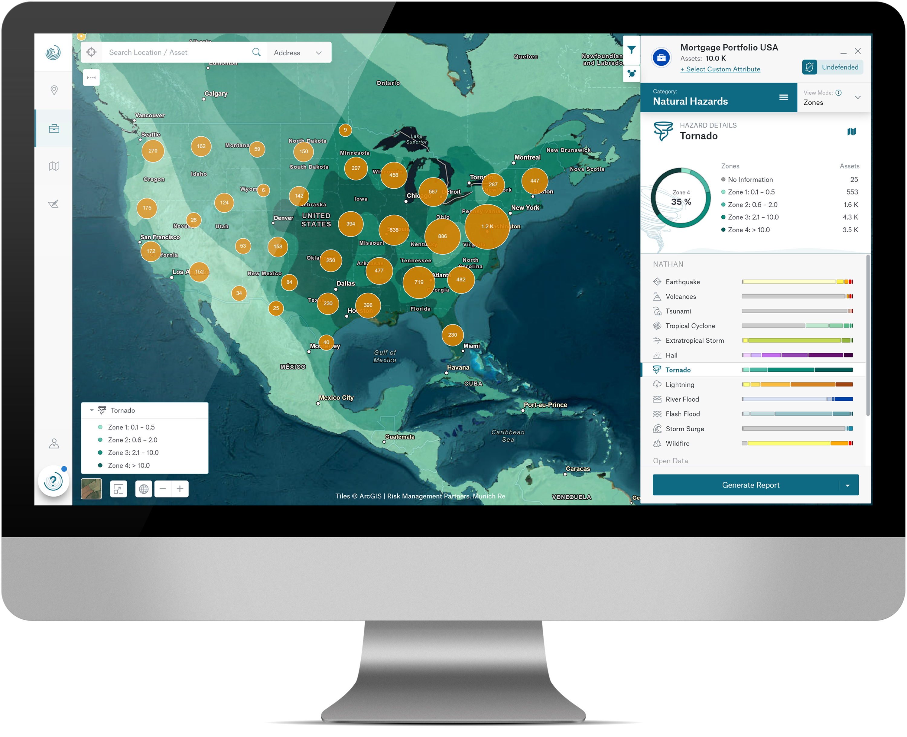
Munich Re offers high-quality natural hazard expertise for the performance of efficient exposure analyses for your individual risk locations or entire portfolios. You can cluster main risk hot spots, filter dynamically and identify accumulations in your portfolio to create greater understanding for better decisions.
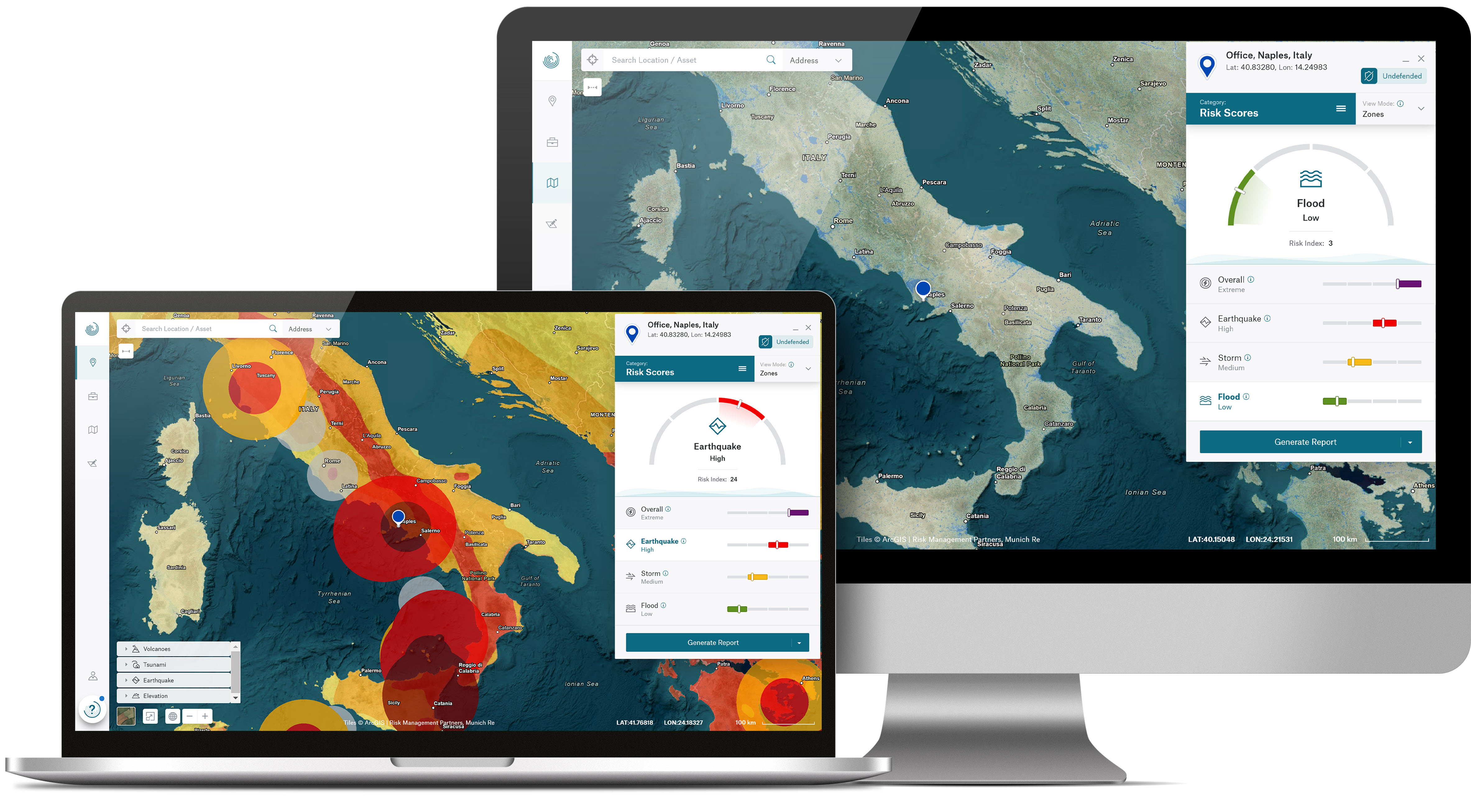
In addition to the comprehensive Overall Risk Score, which is based on the three individually accessible detailed Risk Scores for Earthquake, Storm and Flood, users receive dedicated ratings for a total of 15 Natural Hazards: River Flood, Flash Flood, Storm Surge, Tropical Cyclone, Extratropical Storm, Hail, Tornado, Lightning, Earthquake, Volcano, Tsunami, Wildfire, Subsidence, Avalanche, Landslide. The hazard datasets are pre-integrated and delivered in a consistent format from a single source.
All analysed locations are visually displayed in the form of detailed Natural Hazard Maps with individual layers per risk and can be saved as reports together with all individual scores.
You can also increase the profitability of your business with optimum risk diversification and advanced portfolio management. Thanks to maximum data processing speed and security, Natural Hazards Edition gives you a time-efficient and secure user experience. Over 50 million risk assessments every year and an annual customer satisfaction score of over 90% demonstrate that this is a globally proven, trusted tool.
How is Natural Hazards Edition different from Climate Change Edition? Natural Hazards Edition covers current exposure to 15 natural hazards. Climate Change Edition adds forward-looking projections under RCP and SSP climate scenarios, covering how hazard intensity and frequency will change in specific locations by 2030, 2050, and 2080, and additionally providing 13 Climate Hazard Scores. This long-term focus is a key ingredient for forward-looking credit or investment decisions.
What scores does Natural Hazard Edition provide?
NATHAN Risk Scores
Four composite NATHAN Risk Scores, Overall, Earthquake, Storm, Flood, enable you to gain an overview of your risk situation and quickly identify high-risk assets. They aggregate the risk of each asset in the portfolio in terms of geophysical, hydrological, meteorological and climatological hazards by drawing on data from Munich Re’s long years of claims experience and expertise in natural catastrophe modelling.
Natural Hazard Scores describe the hazard level of a location for all hazards.
15 Natural Hazard Scores based on historical event data and present-day risk models, covering River Flood, Flash Flood, Storm Surge, Tropical Cyclone, Extratropical Storm, Hail, Tornado, Lightning, Earthquake, Volcano, Tsunami, Wildfire, Avalanche, Landslide, Subsidence.